Not All Heroes Wear Capes
Originally posted on May 24, 2018 at 18:22 pmOr: Why I Always Carry a Map
Mountain biking is a lot like the military in two ways: It’s a family and operates as an “army of one” (in most every other way it is probably the exact opposite). So it was fitting that I got completely lost riding alone in the Jemez Mountains near Los Alamos, New Mexico, and that I was saved by a lone uniformed rider, a member of my cycling family by nature of being on the trail. There was one thing odd, though: His uniform was completely purple.
I was training for the Great Divide Mountain Bike Route, and this was one of my last big pushes before tapering off to have fresh legs on July 2nd when I would ride from Calgary to Banff to begin my adventure. In Santa Fe, New Mexico, where I had just relocated, I loaded up my bike with everything I planned on taking with me on the GDMBR and made plans to meet friends at a wild hot springs spot in the Jemez Mountains of Los Alamos for a picnic.

It was a hot, mid-June day, the hottest month of the year, and my route took me through back roads of Tesuque and Pojoaque. It had been a wet, cold winter in the high desert and the sudden hot temps flooded the typically dusty roads and turned them into sandy mud pits: a great test for the ride I was about to set out for in two weeks. As I rode along, donkeys, chickens, and other curious livestock stepped into the road and then back to their grazing areas, interest momentarily piqued before settling into the bored haze of summer.
Once I pulled on to the main road that climbed into Los Alamos, the desert sun sang in my ear like a shocked angel as it evaporated all the water from my body, and I couldn’t help but sing to myself, however hard the climb and harsh the heat. This was just heat stroke setting in, but it felt pretty good for a while.

It was in that sunstroke haze that my overheated phone’s GPS started to turn off and on, and I was rerouted up increasingly suspect roads, dirt roads and trails as the forest crept up around me and the puddles I’d ridden through hours ago now felt like a mirage. The Jemez Trail System has some technical trails with steep, rocky climbs and descents. I’ve never been one to overtly trust technology, and while I knew in my pounding heart that I was being misled, I was helpless against its directives, too turned around to locate a better route. I kept riding upwards through the woods, pushing myself toward the break in the trees, feeling that must be the peak of this mountain and that I would finally get to descend.
Once I broke free from the shade of the trees, I could see clearly what I had been directed towards: a precarious ridge, climbing at a medium grade for what looked like miles, wrapping around in a horseshoe until descending into more forest on the other side. I took out my phone again, by now covered in mushed banana from the poor packing of my handlebar bag. The battery was precariously low, which didn’t matter since it had become so hot it didn’t really work and the map was just a confused frown on my screen. According to Strava, I’d gone about 40 miles, all climbing. “This is great training,” I told myself, “I enjoy riding bikes I am having a good time this is something I want to be doing.” I sucked at my hydration hose. I was just about out of water, but I could tell from the feel of my pack that I wasn’t totally screwed as long as I found a water source soon. Even with the busted banana, I still had plenty of food. I took a deep breath and pedaled on, careful of the loose dirt that spun out under my weighted tires and down the cliff next to me.

If there’s one life lesson that I’ve picked up from mountain biking (besides to always carry a map), it’s to always look forward (literally and psychologically). So I picked my sorry head up from my stem and saw a purple blur whizzing toward me from the vantage point of the horseshoe. As he approached, I dismounted and pulled to the edge of the trail to let him pass. He said hi and did the typical check-in to make sure I was OK.
“I’m OK, just a little turned around. I’m trying to get …” At this point I started crying, overwhelmed at my reality that was finally sinking in, now that I wasn’t focused on terrain and not falling off the cliff. This was the first person I’d seen in hours and turned out to be the only person I’d see on the trails all day.

He offered me food and water, and then the ultimate life-giving source: praise for having climbed the single track on a loaded rigid bike with drop bars. The Quemazon Trail, he said, was typically enjoyed as a downhill trail on full-suspension bikes. Justified in my exhaustion, I wiped the dust and tears from my eyes.
“So, if I am trying to get to the hot springs—
“You can either keep on in this direction around the horseshoe, then rappel-a-bike down that cliff there to the road and ride for another 20 miles …“ —I could feel my eyes starting to water— “or you can follow me back down and I’ll show you how to get there more easily.”
I followed my purple trail avenger down rocky doubletrack, suddenly remembering that I really DO love riding my bike, and this really WAS something I chose to do. My smile got so big I had a hard time seeing, and I tasted the salty sweat and tears that had baked to my face in the dry New Mexican heat. I laughed at how naive I had been to get myself into that situation, and how foolish to not trust that Mountain Bike Magic would come through and save my dumb ass.
My purple hero stopped in front of a particularly challenging switchback.
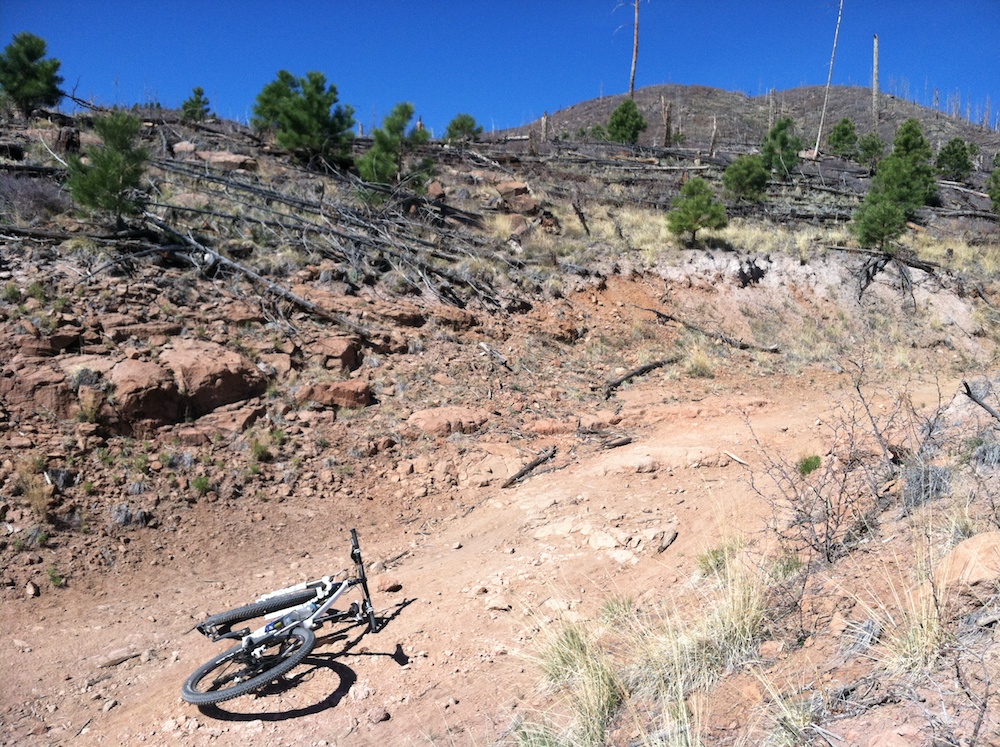
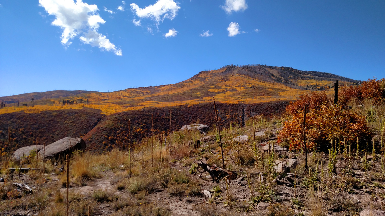
“I often walk this section even on my Yeti,” he said, “so let’s not even try it and instead check out how incredible that burn line is.” The view in front of us was charred from the Cerro Grande fire of 2000 that destroyed 48,000 acres, demolished homes and buildings at the Los Alamos National Laboratory, and displaced 400 families (in 2011, the Las Conchas fire set ablaze 150,000 acres but spared the town and the lab). A hundred yards down, we stopped again. “This is where I proposed to my wife.” We stood in awe for another moment of nature’s ability to transform and adapt, to keep going in harsh conditions.
I took a quick bite of a peanut butter sandwich and mounted my bike that I again loved, carved the dust trails that were now in that golden hour just before sunset, glowing and shimmering with all the minerals in the ground, the brown and red rocks alive, the ponderosa pines on our side of the mountain incredibly brown and green, the fire-scarred trees on the ridge black against the bright blue sky.
Once we got to the bottom of the hill, I asked my lycra-clad friend what his name was. I had been so rude in my haze when we first met that we never exchanged pleasantries.
“They call me Purple Chaos,” he said. “I live right over here if you need anything, otherwise the trailhead you probably got on is right over there, and you should be able to find your way to where you’re headed, if you’re still headed there.”
I turned to call my husband with the last of my phone battery to tell him I was alive and could use a lift in the car, and when I turned back to the Purple Chaos*, he was already gone, presumably off to help another idiot in distress.
*I reached out to the Purple Chaos, known formally as Purple Chaos Cycling, via Facebook for this story. My purple savior’s real name is actually Dr. L. Jonathan Dowell, Ph.D. Dr. Dowell took incredible photos during his ride on that day, and on other rides through that trail system, and was kind enough to share those with us, as well as annotate on his Strava map the various points of interest relevant to this story.
