Access: How to build friggin’ awesome mountain bike trails (that are actually legal)
Originally posted on October 2, 2017 at 1:26 amBy Leslie Kehmeier
If there is one thing that government agencies and advocacy organizations are known for, it’s acronyms. I call it the alphabet soup. In my 15 years of combined experience working for both genres, I’ve been through my share of meetings filled with full sentences of fake words that actually mean important things. To be completely honest, there were plenty of times when I just wanted to put my head down and go to sleep. In recent years, the tide has turned and I’ve joined the ranks, collaborating with the government machine on a project that is named with one of those funky acronyms. Of course, I think this project is totally different (and subsequently awesome because it’s related to mountain biking). Before you yawn, call me a sellout and turn the page, stop and give me a chance to tell you about something called the GQTE.
If left to us mountain bikers, we would have named the Guide for Quality Trail Experiences (GQTE) How to Build Fucking Awesome Trails That Are Actually Legal (HTBFATTAAL). Thankfully, the Bureau of Land Management, commonly known by the acronym BLM, is smart enough to leave the review of titles out of the public process. Although the GQTE won’t win any awards for its name, it will definitely make significant impacts on how mountain bike trails get planned, built and managed now and into the future.
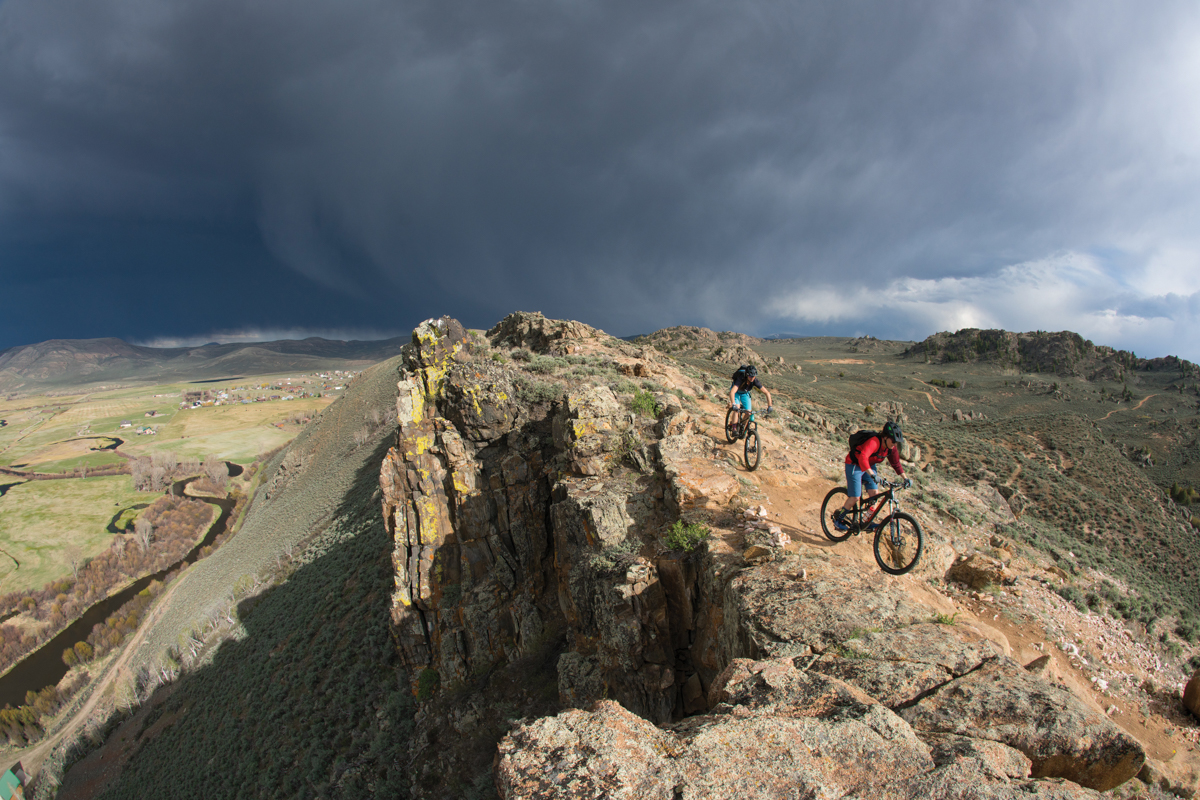
The GQTE, released earlier this year, is actually a long-overdue update to the BLM’s National Mountain Bike Action Plan. Ugh, yes, I know, another painfully boring title. Stick with me here, because this plan is why some of your favorite trails and the most excellent mountain bike destinations exist. Captain Ahab in Moab? That’s BLM. Phil’s World in Southwest Colorado? Also BLM. For the East Coast riders still reading, you might know Meadowood, a new trail system in the heart of metro D.C.? Yep, you’re getting the hang of this game; it’s BLM as well. The list goes on with notable trails and trail systems up and down the Pacific Coast, throughout the desert Southwest and across the Rocky Mountains.
More than just a plan used internally by the BLM, the GQTE is the evolution of the agency’s national strategy. In essence, it is a new set of guidelines that can be used in any location, across unlimited landscapes, for all types of mountain bike trail scenarios. Although its primary use is for the BLM to provide their staff with a resource to better communicate what constitutes a quality mountain biking experience, the GQTE sets the stage for ensuring that all stakeholders, including trail builders and local riders along with the managing land agency, are working together to design and create more intentional experiences and outcomes (aka those fucking awesome trails I mentioned earlier).
Too many times in the past we’ve seen or heard the story about new trails that don’t quite make the mark when compared to the original vision. Very often that scenario has been the result of a vague conversation between a land manager, a trail builder and a rider using terms like “flowy” and “rowdy” that have been completely misinterpreted by some or all in the group.
With the GQTE in place, that exchange about a “rowdy” trail is likely to shift toward “I mean ‘rowdy,’ like it shows on page 35. See the gnarly looking, uneven rocks on that downhill section?”

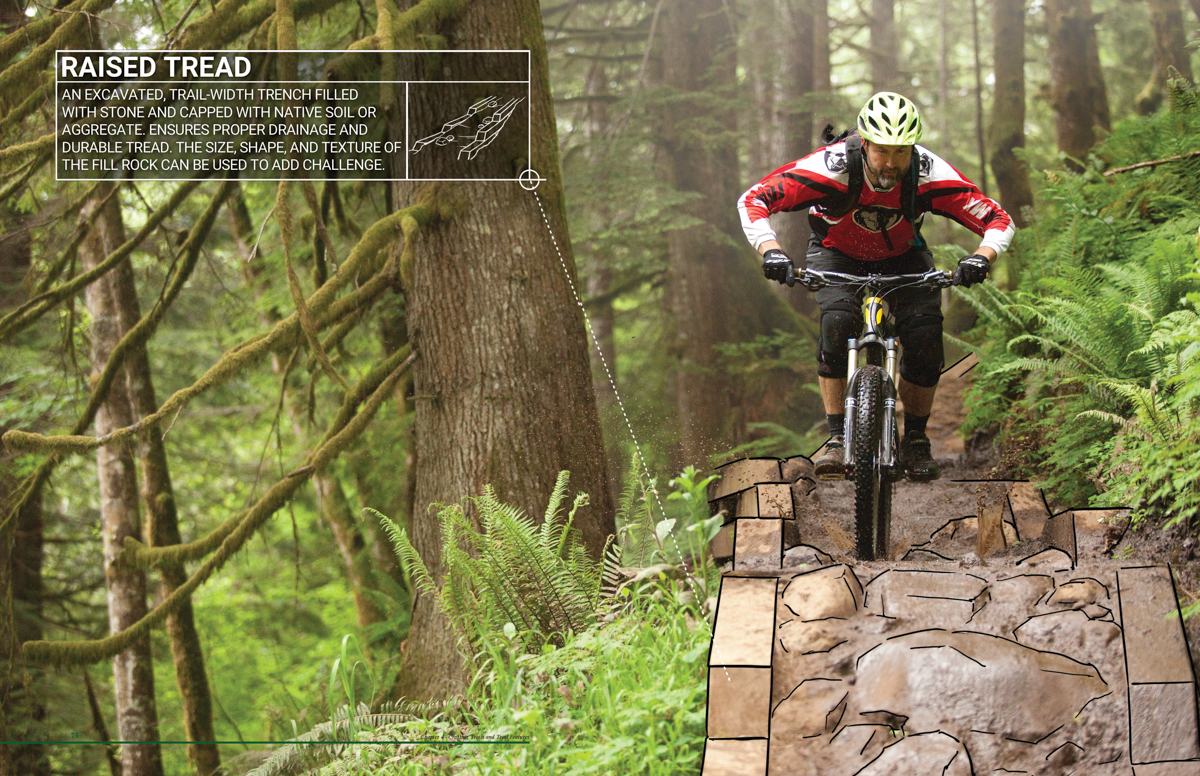
When the BLM embarked on the GQTE project, they decided not only to take a progressive approach to the process but to reinvent their communication materials as well. Although GQTE is still a government document, it’s one of the prettier ones you have ever seen. It’s even, dare I say, stylish. The adage “a picture is worth a thousand words” is so cliché here, but so applicable. The BLM took this saying to heart when they created the GQTE, collaborating with IMBA Trail Solutions and a core of talented professionals with diverse skill sets and geographies. Rather than hundreds of pages of words, the team designed a color-coded flip reference, integrating meaningful text with photography and drawings. It not only creates a common language to better describe best management practices for designing, building and maintaining mountain bike trail experiences but it also literally brings the objectives and elements to life with images from actual BLM locations.
At the same time that a land manager, trail builder and rider are talking about the desired outcome for the trail experience, they can also use the GQTE to see which features are needed to achieve their goal.

Beyond trail experiences and features, the GQTE recognizes the importance of the landscape as a major factor. Not all trails and features are appropriate for all landscapes because not all landscapes are the same. Moab, Utah, with its arid climate and abundance of rock, is quite different than the lush forests and loamy soils of the Pacific Northwest. Factors like terrain, soil and climate become integral to the conversation.
While the GQTE will provide new guidance to design, plan and manage high-quality mountain biking trails, it will also continue to hold a high standard for natural resource protection as in previous versions of BLM’s national mountain bike strategy. In addition to caring for the land, the document also expands the sustainability conversation to include the economic and social pieces. These components, along with the rest of the GQTE, are important concepts when trying to achieve the idea of durable, engaging mountain bike experiences that will last for generations.
As for the future of the GQTE? I don’t expect to see it gathering dust on the shelves of government staff or become irrelevant in terms of the progression of mountain biking. Refinement of the GQTE will be ongoing and keep pace as new information becomes available. Future projects and funding will drive the expansion and updates of the materials.

FAQs
WHAT is this thing called the GQTE?
The Bureau of Land Management (BLM), working in collaboration with the International Mountain Bicycling Association (IMBA), developed the Guide for Quality Trail Experiences (GQTE) as a comprehensive approach to trail planning, design, construction and management specific to mountain bike trails. GQTE is both a printed reference and online document available to everyone. Visit gqte.imba.com to download your copy.
WHO is the GQTE for?
The GQTE provides guidance and establishes best management practices for BLM field office managers and staff, interest groups and individuals. Beyond the BLM, the tools and techniques in the document are likely useful for other private, local, state or federal land managers, trail builders and trail-advocacy groups looking to sustainably manage mountain bike use.
HOW do I use the GQTE?
The GQTE is formatted as a flip reference. The chapters are color-coded along the edge to allow for quick location of the appropriate section. The GQTE should be referenced during all phases of project design and development as well as during construction and maintenance. In addition to IMBA’s website, the GQTE is also accessible at blm.gov/sites/blm.gov/files/uploads/Travel-and-Transportation_Guidelines-for-a-Quality-Trail-Experience-2017.pdf and includes additional interactive tools that aren’t available in hard-copy versions of the guidelines. The appendices include real-world examples of BLM planning projects that have incorporated the GQTE process as well as a library of resources to assist with all phases of mountain bike trail planning, design, construction and management.

WHEN is it appropriate to use the GQTE?
When your community is planning a new (or modernizing an existing) mountain bike route. The GQTE outlines a general approach to trail development that can be applied to any trail project regardless of scope, scale or location. This approach allows for the flexibility to develop relevant trail designs within a variety of settings, resulting in solutions that are responsive to the unique physical, social and environmental circumstances presented by a particular area.
WHERE has the GQTE been put into action?
The Mountain of the Rogue Trail System (MOTR), located in Rogue River, Oregon, is the best example to date. The principles of the GQTE were utilized early in the visioning and design of the trail system, as well as during construction of the first phase of trails. Anyone who rides MOTR will have unique experiences from trail to trail, just as they were intended.
WHY is the GQTE important?
Whether we know it or not, we as mountain bikers are on a quest for extraordinary riding experiences — something that is ever changing. And if what we want is always evolving, so too must the process by which those experiences are communicated, planned, designed, constructed and managed.
