The Hidden Downieville
Originally posted on June 27, 2017 at 1:17 amWords by Kurt Gensheimer, photos by James Adamson
California is home to nearly 40 million people. With constant urban and suburban sprawl, it’s a state where change and “progress” is inevitable. But there is a corner of California called the Lost Sierra that hasn’t changed much since the 1849 Gold Rush. Plumas and Sierra counties make up the Lost Sierra region, roughly a 40-by-40-mile area bordered to the south by Downieville, to the north by Quincy, to the east by Graeagle and to the west by La Porte. The Lost Sierra is one of the only places in California where the population today is less than it was in the 1860s. A collection of “drinking towns with mountain biking problems,” the Lost Sierra is one of the most historically rich and least visited regions in the Sierra Nevada, ripe with abandoned mining camps and crisscrossing historic prospecting trails.
Mountain bikers are familiar with names like Butcher Ranch, Pauley Creek, Big Boulder and First, Second and Third Divide — classic Downieville trails offering up more than 5,000 vertical feet of descending in less than 20 miles. But there is another side of Downieville that most people don’t know. Referred to by old-timers and history books as the “Over North” region, the terrain directly north of town is extremely primitive and rugged. Most trails are accessible only by your own lungs and legs, an off-road motorcycle or a capable 4×4. If matters go south, you can be at least 20 miles in any direction away from help, and within those 20 miles usually lie two massive canyons at least 3,500 vertical feet deep each.
Settlements like Howland Flat, Poker Flat, Gibsonville, Onion Valley, St. Louis and Nelson Point were once thriving with thousands of prospectors and their families. Now they are nothing more than collapsed piles of wood completely overtaken by Mother Nature. Although the frontiersmen who tried to settle this untamable region are long gone, the trails remain. They’re the type of old-school prospecting routes that completely crush the soul on the ascent, then, like the Phoenix, resurrect the soul with some of the most challenging and rewarding descents you’ll ever ride — assuming you don’t burn through an entire set of brake pads in the process.

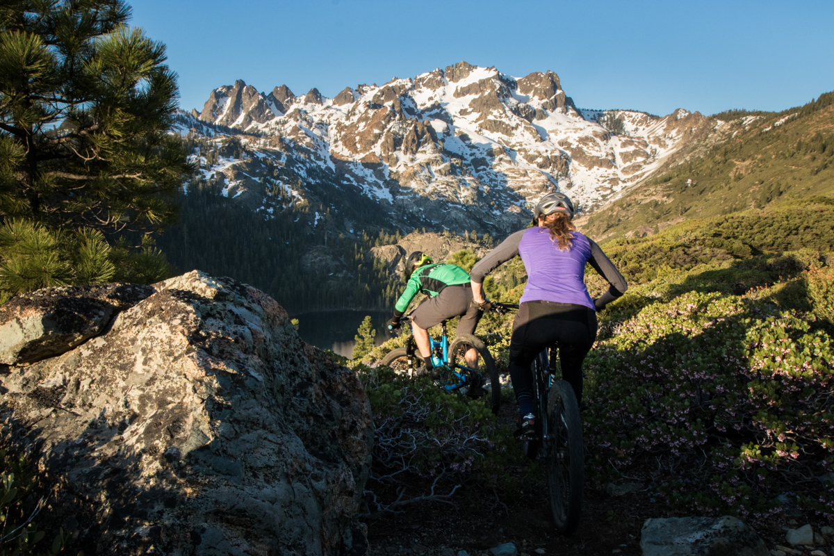
Over North Region
Accessing the Over North region from Downieville is as easy as pedaling west on Highway 49 out of town about a half mile to Saddleback Road, which is where the easy part ends. The road immediately turns to dirt and points aggressively skyward. About 8 miles into the climb, you pass the Saddleback Mountain turnoff, towering nearly 4,000 vertical feet above Downieville at 6,625 feet. Approximately 5 miles past Saddleback, you reach Chimney Rock Trail at nearly 7,000 feet of elevation, offering a number of options for a rip-roaring descent back to Downieville, which sits at a mere 2,800 feet.
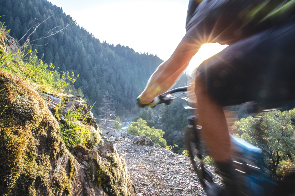
About a mile before Chimney Rock is Herkimer Mine Trail, an extremely narrow singletrack running down the shoulder of a ridge with an unrelenting pitch and remarkable views. Herkimer is a true brake-scorcher of a descent, dropping nearly 2,500 feet in a mere 2.5 miles, connecting with the Downie River Trail. For those brave enough, Herkimer can be ridden with egregious speed, but trail detritus and a few spots of loose, off-camber shale generally keep that speed in check — that and the fact that help is a long way off.
Right at the Chimney Rock Trailhead is Rattlesnake Creek, a longer option that eventually connects with the bottom of Herkimer and Downie River trails. Rattlesnake starts off totally obnoxious, an old jeep road with some of the most off-camber, steepest pitches and biggest water bars I’ve ever ridden, tastefully accented with a giant scree field halfway down that’s a compound fracture waiting to happen. Recognizing its danger, the Downieville Ranger District of the U.S. Forest Service recently approved a plan by local trail-building heroes the Sierra Buttes Trail Stewardship (SBTS) to construct a new singletrack that will bypass the roughly mile-long unsustainable jeep road. It’s just one of many new exciting trail projects slated for the Downieville region in the coming years.
After the rowdy entry, the trail turns into an incredible singletrack following Rattlesnake Creek with challenging technical rockiness, fun drops off huge exposed tree roots, numerous thigh-deep stream crossings and evidence of man everywhere in the form of massive tailings piles of rock. Rattlesnake Creek and Downie River were among the most productive tributaries of the North Yuba River for gold. Like many of the trails in the Lost Sierra, Rattlesnake Creek is as much a portal through history as it is a bona-fide backcountry ride.
Just below the junction of Rattlesnake and Herkimer, Downie River Trail picks up as a fast, flowing singletrack running past a historic mining cabin owned by Feather, a longtime Downieville local who runs La Cocina de Oro, a must-visit post-ride Mexican restaurant in town. This cabin is at least a 45-minute pedal upstream from Downieville, containing at least 5 miles of rugged jeep road. Feather gave birth to her son and raised an entire family in that cabin on the bank of the Downie River. A cabin with no running water and no electricity. A cabin that’s buried under 5 feet of snow half the winter. And Feather had no car or motorcycle. She either walked or skied to town, as did her kids, who made the nearly two-hour walk each way every school day. But she tells the story much better than I can write, so ask her about it when you visit.
Still another option off the ridge exists, and those with bigger aspirations can stay high and ride Chimney Rock Trail, an otherworldly experience with commanding 360-degree views of the entire Lost Sierra and volcanic terrain that resembles the moon more than the Sierra Nevada. After climbing more than two hours to reach Chimney Rock, the climbing gets tougher thanks to the soft volcanic soil and massive rock formations. Be warned, there will be points on Chimney Rock that reach Type 2 fun, especially in early season when there are still 5-foot-deep snow drifts, but the views and the eventual arrival at Empire Creek Trail will quell the suffering.
Rather short but incredibly sweet, the Empire Creek singletrack starts off with numerous switchbacks, then opens up into a high-speed straight-line descent to guarantee perma-grin. Because it’s usually ridden only by a handful of motos, once the early season fallen trees and detritus are cleared, Empire stays buff months after trails like Butcher, Pauley and Third Divide get blown out. And for those who would rather not endure the long climb to the top of Chimney Rock, Empire can also be ridden as an out-and-back from Downieville, but bring those climbing legs, ’cause it’s a doozy.
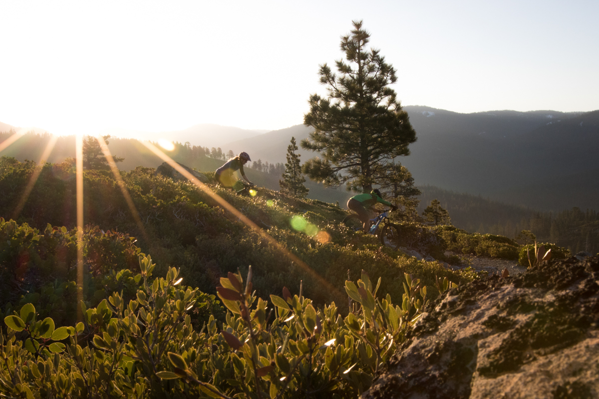
Off the Saddle
Most folks who’ve been to Downieville are familiar with Packer Saddle, the shuttle drop-off point 20 miles northeast of town that sits in the shadow of the mighty 8,500-foot-high Sierra Buttes. While most folks hit the traditional Downieville Downhill back into town, one of the very best descents in the region goes largely unridden most of the season: Lavezzola Creek Trail. Lavezzola was one of the original wagon routes used in the 1850s to get out of Downieville and over the Sierra Crest to Johnsville, Graeagle and the Sierra Valley. Accessing Lavezzola can be challenging, which is part of the reason why it rarely gets ridden. But those who pedal 10 miles along the crest following the historic Oakland Pond Trail will be rewarded with commanding 360-degree views of the Sierra Nevada and the Lakes Basin, a series of high-alpine lakes amidst remarkably rocky peaks. The views and eventual descent on Lavezzola are worth every calorie of effort riding along the Sierra Crest.
One of the greatest sensations is to fill up your water bottle at the source of Lavezzola Creek, a mere spring with a small pipe coming out of the hillside, then, for the next 15 miles, following Lavezzola Creek until it grows into a raging torrent of winter snowmelt, finishing the ride by cooling off in one of the numerous swimming holes on the north side of Downieville. Lavezzola Creek Trail has sections of singletrack that will make virtually every modern flow trail seem inconsequential. Lavezzola is the original flow trail, more than 150 years old, and because it hardly gets ridden, it stays loamy and prime through the summer.
From the Sierra Crest, Lavezzola starts out steep and rocky, with a few pucker sections of loose off-camber pitches and scattered rocks, but not nearly as harrowing as Rattlesnake. After a couple miles, Lavezzola mellows out in steepness, but the rockiness continues, with several stream crossings that are rideable depending on creek level. After that, the buff, fast, straight-line singletrack takes over, hurtling you downward with speed and daring you to let off the brakes just a little more. Go ahead: There’s a long sight line and no real unexpected surprises. Eventually Lavezzola opens up to a narrow doubletrack with numerous gently shaped water bars perfect for boosting off, especially fun when running two abreast at speeds north of 30 mph. Lavezzola then meets the bottom of Third Divide, and for those familiar with the classic Downieville Downhill route, you can roll First Divide all the way back to town.

Into the Basin
The Lakes Basin is a playground of technical rockiness and breathtaking vistas that could easily be mistaken for the Swiss Alps. In the basin, rides are measured in “dog miles” because every one feels like seven. Some rides in the basin can be in the single digits for mileage and be three hours in length, which is why most visitors pass over the basin. But for those hardy souls who love techy challenges and unparalleled natural beauty, check out Long Lake Connector Trail, Round Lake, Mud Lake and Gray Eagle Creek Trail.
Gold Lake Highway runs directly in between two peaks that tower above the basin: Mills Peak to the east of the highway and Mount Elwell to the west. Although these peaks are a couple miles apart, the trails couldn’t be more different. Mills Peak is an SBTS creation, completed five years ago with financial support by Ibis Cycles, nearly 12 miles in length and more than 3,000 vertical feet high. Although there are some rocky sections of trail, the rocks fit the trail perfectly, encouraging more speed and flow with each ride down. A rider familiar with Mills can turn a lot of the embedded rock into boosters and drops, and if you can follow someone who knows Mills well, you’ll be amazed at how fast you can ride it.
Mount Elwell is an entirely different story. Elwell’s ridge runs like a long spine above the basin, loaded with massive boulders and huge scree fields of rock. Getting to the top of Elwell is a serious task. The fittest of fit riders can ride 90 percent of the climb from Mud Lake, but that last 10 percent, everyone will walk. You’ll want to walk it anyway: The views of the Sierra Buttes, Lakes Basin and Eureka Peak are mind blowing. Unlike Mills, there is no gradual entry; it’s game on from the first wheel rotation, with numerous rock drops and loose boulders scattered everywhere. Unlike Mills, which has lots of embedded rocks, Elwell’s rocks are free agents, peppered everywhere and just waiting for an unwitting pilot.
“Rowdy” is the one-word description of Elwell’s upper section. But once to Smith Creek Trail, rockiness is turned down a few notches and steep, fast, straight-line action takes over. Lower Smith Creek Trail might be one of my favorite sections of trail in the entire region; it’s obnoxiously fast and fun in spots, and because of its low usage, stays rather buff well into the summer. Once to Gray Eagle Creek Connector, you’ll gain a couple hundred feet, then get another extended payoff of downhill on Gray Eagle Creek Trail, taking you all the way into the town of Graeagle after nearly 4,000 vertical feet of descending.
As good as Mills and Elwell are, there’s a third trail off the Sierra Crest that’s even more remarkable. Jamison Creek Trail almost never gets ridden. It’s not very hard to access, but for whatever reason, nobody has heard of it. Marc Cosbey, aka Cozmo, one of the SBTS originals (along with Greg Williams and notorious scribe Mike Ferrentino), spent multiple summers enhancing Jamison Creek, turning it into a world-class trail that professional enduro racer Ben Cruz ranks among his all-time favorites. Cruz recently moved to the Lost Sierra because of Jamison Creek and ranks it among the most challenging, beautiful and enjoyable trails he’s ever ridden anywhere in the world. For him, trails like Jamison and Elwell are the ultimate training grounds.
Jamison is most easily accessed from the historic mining camp of Johnsville, 3 miles up the mountain from Graeagle. “Easily” is relative; the 2,000-vertical-foot climb from Johnsville to the Sierra Crest is no stroll, but the historic fire road is a steady gradient with a decent surface. Once to the crest, Jamison drops in aggressively, with a steep, off-camber pitch mixed with loose rock and dirt resembling kitty litter. The trail transitions into bigger rock, with numerous tricky sections and tight corners. After crossing a meadow along the shores of Grass Lake, the trail takes on a different character, with the remaining mile of downhill featuring stair-step natural rock than can be either rolled or, for the brave, hucked with irrational exuberance. The trail finishes at the historic Jamison Mine, one of the most productive gold mines in California history. For the expeditious, venture off the trail and search out all the old mining equipment; it’s everywhere. Then cruise through the historic village of Johnsville to the Iron Door and refuel with some grub and grog.

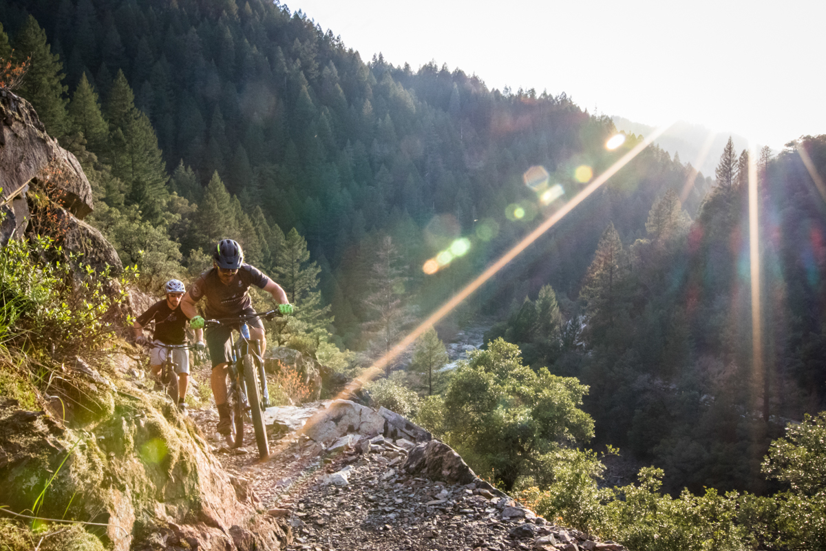
North Yuba Trail
The closest singletrack to the center of Downieville is the North Yuba Trail, Downieville’s version of a “river trail” — a 14-mile, undulating singletrack that will constantly test fitness, technical fortitude and cornering skills. This trail is divided into two sections, with the village of Goodyears Bar in the middle. The most recent 7-mile section was completed in 2011 after more than a decade of work by the SBTS hand-cutting the entire thing through incredibly steep and rocky terrain. In that time, SBTS founder Greg Williams had his life changed by the trail in many ways.
“During the time North Yuba was being built, I became a husband and a father,” says Williams. “And I watched Henry O’Donnell grow from a scrappy little 15-year-old who won the Downieville Classic pro category into a husband, father and head of our trails crew. For me and many in the Stewardship, the North Yuba is as much a time machine as it is a trail.”
Literally a two-minute pedal from the Yuba Expeditions bike shop, North Yuba starts off along the namesake river, passing by Finney Rock and one of the most glorious swimming holes in all of Downieville. After Finney Rock, the trail shoots skyward, rather steep for the first half mile, then mellowing into a manageable gradient, albeit with some very tight switchbacks. The trail quickly gains elevation, and town can barely be seen through the thick canopy of massive second-growth pine trees. In the 1860s, every towering ridge enveloping Downieville was bare, denuded of its foliage for the birth of the mining industry. Occasionally you’ll come across an old-growth tree. You’ll know this because instead of it being 4 feet in diameter, an old-growth tree will be 8 feet in diameter.
North Yuba must be ridden with razor-sharp precision. This is no daydreaming trail. If you lapse in attention for even a second, North Yuba will get your attention back quickly. Botching a corner can result in quite a serious tumble, as the 18-inch-wide trail is bench-cut into a dramatically steep slope. And even if you are paying close attention, stubby overgrowth can clip the bars and overhanging rocks can hit the feet, suddenly changing your trajectory and catapulting you off trail.
Once to the top, you cross a bridge and the eventual connection with the Mexican Mine Trail — a yet-to-exist trail that will be critically important in connecting Downieville with another historic and forgotten mining camp, Forest City. Forest City sits more than 2,000 vertical feet above Downieville and warrants a feature all its own, with more than 35 miles of barely ridden singletrack professionally built by the Forest Trails Alliance. For anyone visiting Downieville who wants a completely unique riding experience on incredibly flowy trail reminiscent of those in Oregon, ask the crew at Yuba Expeditions or Downieville Outfitters about Forest City and they’ll give you the insider knowledge, as there is very little on the internets.
After the bridge, North Yuba descends for the next 3.5 miles, a really fun rip down tight switchbacks with long straight-line sections mixed in. After a great downhill romp, you arrive 5 miles downstream in Goodyears Bar. Pedal through town and look at the historic St. Charles Hotel, now a private residence, one of the oldest buildings in the region. Up Mountain House Road a quarter mile from Goodyears Bar, North Yuba continues for another 7 miles. Along this section the views of the North Yuba River are remarkable, reminiscent of iconic river trails like North Umpqua and McKenzie River Trail in Oregon.
Unlike the first section, which has a big climb and a big descent, the next 7 miles are like multiple stabs in the chest, making you fight with everything you have to keep the wheels moving uphill. But with each stab comes a payoff, and after crossing a beautiful bridge over the river 14 miles later at Rocky Rest Campground, you’ll feel quite accomplished. For those who don’t believe in shuttling, just turn around and ride it another 14 miles back to Downieville. The trail is a completely different beast in the opposite direction and you’ll earn twice as much beer afterward for the effort. For those who can’t quite commit to 14 extra miles, do the first 7 miles to Goodyears Bar and ride Highway 49 for 20 minutes back to town. North Yuba can also be ridden as a loop with Halls Ranch and Fiddle Creek trails thrown in. However, be warned: That’s a biggun’ of about 30 miles and 6,000 feet of climbing with some soul-crushing uphill pitches on Halls Ranch.
There is so much more to the Lost Sierra region, but the trails described here should give even the hardiest of backcountry adventurers a full week of challenges, rewards and unforgettable memories on the bike. The Lost Sierra is as much a stroll through history as it is one of the best backcountry playgrounds in North America.

Pro Tips:
- When staying in Downieville, bring ample food, as there are limited restaurant options and just a bare-bones market.
- The Downieville Loft (airbnb.com/rooms/2042514) and Willoughby’s on the River (willoughbysontheriver.com) are two amazing rental properties in the area.
- Carriage House (downievillecarriagehouse.com), Downieville River Inn (downievilleriverinn.com), Lure Resort (lureresort.com) and Sierra Shangri-La (sierrashangrila.com) are all riverfront lodges.
- Nakoma Resort in Clio (nakomaresort.com) is only a few miles from Mills Peak Trail, featuring a brand-new lodge and a bike shuttle service.
- Yuba Expeditions (yubaexpeditions.com) in Downieville is a nonprofit bike shop and shuttle service, with all proceeds going back to SBTS to employ local folks who make all the trail construction magic in the Lost Sierra happen. Your money is well spent here.
This piece originally ran in Dirt Rag 196. Subscribe now to never miss an issue and sign up for our weekly email newsletter to get fresh content delivered to your inbox every Tuesday!