Riding on the Dragon’s Back in Roanoke, Virginia
Originally posted on June 12, 2017 at 1:00 amThere was a hint of skepticism on my guides’ faces as we stood in the parking lot and they looked all 5’3″ of me up and down, no doubt trying to decide if it was going to be a mistake taking me on this ride.
“What’s your overall skill level? What’s the longest ride on dirt you’ve done in the past couple of months? With climbing? How much food and water do you have?”
The barrage of questions was most likely standard for any unknown rider they took out in these parts, but it felt like I was getting a slightly harsher background check being a petite female.
They gave me a rundown of the ride options. Basically, climb the mountain and ride along the ridgetop for a while before dropping back down one of three different trails, depending on time. The ridgetop trail is technically called North Mountain, but most locals refer to it as Dragon’s Back.
“It’s called Dragon’s Back for a reason,” my two guides, Jeff and Ryan, warned me. “The rocks are jagged and stick out every which way.”
“That’s okay. I’m used to riding rocks.”

We started out a rolling gravel road for the first few miles, pedaling easy and engaging in chit-chat to break the ice. By the time we got to the singletrack, we’d warmed up to each other and my legs had warmed up to begin the 1,400 foot climb up Grouse Trail.
The climb wasn’t super steep, but it was steep enough to be a lungbuster, and a few punchy sections and steep, hard switchbacks added to the challenge. A couple of the switchbacks were nearly impossible, but most are doable, provided you have enough energy for that extra pedal push after climbing for a half hour.
The leaves obscured most of the vistas, but there were a few spots where the mountains in the distance peeked through. My guides pointed out McAfee’s Knob, a famous spot along the Appalachian Trail. In the winter or early spring, the views would probably be pretty amazing.
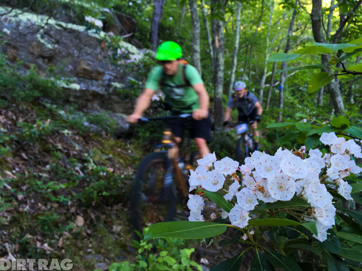
Along the trail, the Mountain Laurel was blooming, its pinkish white flowers highlighted against the bright spring green of the forest and the gray of the lichen-covered rocks.
While we stopped to catch our breath at the top, Jeff and Ryan mentioned that we were making good time, so we’d be able to do the longest ride option they had planned, which would involve riding along the ridge for about three miles, dropping down Turkey Trail, riding along the gravel for a few miles back to Grouse Trail, up to the top of the mountain again, along the ridgetop in the other direction, and dropping off the edge of the mountain back to the car.
We have to climb that again? Shit.
But it was my last day of my trip, I’d be sitting in a car most of the next day, and I was here so I might as well get good and tired. I was also happy to see that my guides were no longer skeptical of my abilities. I guess I had proved myself.
The North Mountain Trail runs along the ridgetop for about 14 miles. It was slightly overgrown in spots, not surprisingly, as getting up there for maintenance is no easy feat. The grown-in areas hid rocks that popped up out of nowhere, and getting whacked in the face with leaves was a common occurrence. There was still a fair amount of elevation gain and loss even on top of the ridge, so it wasn’t quite the break for the legs that I may have welcomed, but it was a ton of fun, a perfect mix of technical and rocky but still very rideable.

At the top of Turkey Trail, we stopped for a snack and passed around a Bell’s Two Hearted Ale, liquid courage for the loose, switchback-ridden descent down Turkey. I wish I could remember as many details about the trail as I do about Grouse, but I was having a little too much fun flying to the bottom.
“Now we have a long slog back up to Grouse,” my guides told me at the bottom. “This is where you get to know your riding buddies, and avoid talking about politics.”
The “long slog” wasn’t so bad – we did spend more time getting to know each other, talking about other riding in the area and the Shenandoah 100.
Back at the bottom of Grouse, we all shared another beer, energy for the climb this time. By now, the heat of the day was setting in, and I was beginning to feel the effects. Our climb was slower going this time around. I didn’t even attempt most of the switchbacks. But we made it to the top again, downed another snack, and set off to finish the last few miles of the ride.
Again, the ridgeline was far from flat. This side had even more punchy climbs that kept me on my toes and did a number on my already-tired legs. As we neared the crest of the mountain, just past Deer Trail, the ridge narrowed, the trail following its rocky spine before dropping off to begin our last downhill back to the road.

The 1,300 foot descent was steep, fast and loose. It was easy to exponentially gain speed – and also probably far too easy to go flying into the woods if you couldn’t slow down in time for the switchbacks that littered the descent. I emerged onto the road with a grin plastered on my face.
The ride that I did was almost 19 miles with 4,200 feet of climbing. There are many different options depending on how far and long you want to ride, though no matter what, there will be plenty of climbing and rocks with a backcountry feel.
Expect to have the trail to yourself (we didn’t see any other riders during our time at North Mountain, and it was a Saturday morning into early afternoon), hike your bike at least a little, and bring plenty of food and water. Check out Just the Right Gear bike shop, located on the way to the trailhead from Roanoke, for info and to stock up on essentials.