Musings on East San Diego County Singletrack
Originally posted on October 28, 2015 at 18:33 pmWords and photos by James Murren
Feature story from Issue #182
The Cuyamacas
 My bike leans against a tree as I walk in cleated shoes through the green spring grasses in the direction of granite slabs slightly visible from the trail. Remembering a group of picnicking students that had piqued my interest during a previous ride, along with a ranger’s indiscernible words of education floating on the sunshiny breeze as I passed by them, I am curious about what is there.
Oaks stand sentinel. Blue sky watches overhead. The Cuyamacas rise in the near distance. Boulders the colors of mountain lions sit idly on the mountainsides. Morteros made by various bands of the Kumeyaay native peoples come into view on the stone’s surface. I imagine a scene of women grinding seeds into a kind of flour. I wonder what they were thinking when they looked up from their work.
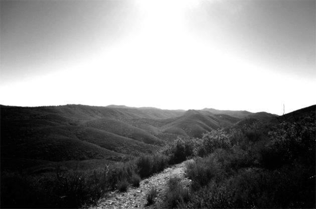
A few minutes of stoppage from my mountain bike ride sets the wheels spinning again. Back on the bike, I continue up West Side Trail in Cuyamaca Rancho State Park, having just crossed over the paved road from East Side Trail, which meanders a little farther south. Seven or eight turkeys scatter away after I cross back over the road at the visitor’s center.
All wheels turning, bike and body, on my way into Green Valley, the wind kicks up. I think of the stone grinders making flour, and I think of the wind as it affronts my face and chest. The landscape opens up. To the east and west, ridges rise up, and classic Southern Californian golden grasses spread out around the two-track trail heading north. I tell myself, “Release your cares here.”
I get off my bike again. Natural beauty enters my eyes. Why do I ride without stopping most days? And, if I am not truly on a timeline, why ride fast? Is there something to be found in slowing down?
The two-track becomes a little rougher on Upper Green Valley before it morphs into the singletrack of La Cima. A few short, dirty climbs creep up here and there. I hear a woodpecker hammering a tree. I am reminded of a television program I had seen years ago about how they are able to strike into trees and not blow up their craniums. The science is lost on me now, but I have not lost the understanding of amazement and wonder.
The narrowing trail quickly makes the ride a more labored effort and I decide to all-the-way-down granny gear it. I see and feel more of the trail. Smatterings of loose, sharp rocks litter the pathway. Yucca plants send out seasonal shoots that will flower in the coming weeks. I continue to climb up to La Cima, knowing that joyous flow, as they say, is coming my way. I stop again, looking back over my shoulder. The western edge of the Colorado Desert, a subregion of the greater Sonoran Desert, wears a beautiful cloak of varying earthen shades.
Up on La Cima, riding along at a spirited pace, I pull on my brake levers. Out beyond the immediate sight lines, I see a large swath of blue. A portion of the Salton Sea, one of America’s greatest environmental catastrophes, is visible.

I think of the Kumeyaay.
People made a life in the desert
And forests here. What do their
Watching eyes see as I pedal
Across their ancestral home?
A bird smiles at me, then flies.
Pedaling on, but not too long, I again come to a stop. Out beyond the immediate foothills, in the far-far northward distance, I see a snowcapped mountain. San Gorgonio Mountain reaches more than 11,000 feet in elevation, the highest mountain in Southern California, and is visible despite being a hundred miles away from me. The sun shines bright, the snowy ridgeline gleaming like a white beacon in the early afternoon air. Standing in the desert, I feel the snow in my bones.
I cross over the macadam and go up Milk Ranch to Middle Peak. The 2003 Cedar Fire devastated the mixed oak/pine forest on this side of the ride. The climb to the top requires patience. A little more than halfway up, I stop at a turn in the forest road and admire the view. I see the Lagunas to the east, with Stonewall Peak, a wonderful hike, in the foreground.
I pass the first Black Oak Trail turnoff on the left, going up to the second one. I get off the bike and stretch. An apple, some nuts, and raisins are my snack. I drink water from my hydration pack and wipe sweat from my brow. About a mile high in the sky now, a little chill falls upon me. San Gorgonio caresses my face.
Back in the saddle, I go down Black Oak; it is chundery and terrific under my tires. I slow-go and choose more challenging lines up top before sloping down to the crossover to Azalea. Up and up some more, Azalea to Fern, and then the long descent begins back to West Side Trail via Fern–West Mesa–Japacha.
I am slow-going no more. At this point, all of my focus is on the immediate earth that rests a few feet in front of my tire. “It will be beneath me in half-seconds” is a passing thought as I go down.
I pass the morteros that I visited a few hours previously. A couple hundred years have passed since they were made. I consider their existence while my bike moves forward at a rapid pace. I am above the seat, my feet on tiny pedals and calf muscles slightly burning. I see the road, but do not squeeze the brakes yet. A big smile emanates from my face.
Back over the road to East Side to the car is my direction. A little taste of desert along the way as the trail undulates, Cuyamaca’s big loop providing me tired legs for the drive home.
The Lagunas
East on the 8, away from the Pacific Ocean, I drive in the direction of Pine Valley, California. My destination is the southern terminus of Noble Canyon Trail, an IMBA Epic; when combined with the trails up in the Laguna Mountain Recreation Area, it’s arguably one of America’s finest mountain bike rides.
On the countertop, a note for my bride of 12 years says: “park at noble canyon trailhead in pine valley…up pine creek to indian creek trail to champagne pass to noble trail to penny pines for water…out into meadows and down to county road back up to chico ravine to gatos & over to red tail roost loop and back to gatos into meadows up to connector to noble canyon…down noble to include extension & drop out at trailhead right at car/parking area.”

She knows that it will be an all-day affair, and that if I’m not back by dark, then a chance exists that something might have gone awry. I know it’s a big ride, and that if all goes well, I will be celebrating with a smorgasbord of food and an Alpine Duet under the Jeffrey pines at the trailhead where I parked my car amid squawking jays and the hard-knocking rhythm of woodpecker beaks smashing into tree trunks sounding out into the dry air.
She has the emergency numbers to call, should she need them. I send a text message from the parking lot before I head out: Beautiful morning! The sky is an impossible blue. Heading out on trail. Te quiero, mi amor.
In my pack are the necessary tire/tube-changing/fixing and chain-break tools. I also have an emergency whistle, duct tape, a light windbreaker, emergency food and hydration tabs packed at the bottom, extra cleats and shoe straps, toilet paper, and some cash in the event that I might need to hitch a ride back to my car. On the outside of my pack is an emergency-information clip that my nephew gave to me. In the pockets are calories in the form of fruit and nuts. In addition to this preparation, I remind myself that I can also walk out if needed. My phone, fully charged, is turned on in the outer pocket of my pack.
I twist and turn in the seat as I work my way up Pine Creek. Getting the chamois to feel “just so” and the hydration-pack straps to rest the same is where my attention is focused going up the lesser-kempt paved road. Half an hour later I’m thankful to be riding dirt as I go straight over a lip in the road onto Deer Park and ride up to Indian Creek Trail. A backcountry feel from the doubletrack prepares my mind for the singletrack to come in the approaching minutes.
I turn right on Indian Creek; the welcoming uphill is a fun slog over loose rocks. I tell myself that someday I will turn left, or come in from that side, determining a way to maximize cross-country riding so that I can combine Cuyamaca with Laguna and Noble, sans shuttle or bailouts to cars. One giant Cuyamaca-Laguna-Noble loop is the goal, to be completed another day maybe.
Indian Creek to Noble, and a left turn over to Penny Pines, is my route. I stop at Penny and drink my entire bottle and nearly all of my hydration pack while adding calories by eating an “all-natural” pastry tart with almond butter. I refill both the bottle and the hydration bladder at the water hand pump sticking up out of the ground.
My ride is about halfway complete, I think, though I don’t really know. Still, at this point, I am quite happy to ride the meadows, knowing they are not that strenuous and are amazingly beautiful. I ride the west side, going down to a pond called Water-of-the-Woods, and then around and up, over, and down to the parking area off of Sunrise Highway where cars line both sides of the road, belonging to mountain bikers, hikers, and birders alike.
I make the sharp left-hand turn onto the singletrack going back up to Old County Road. The day approaches noon; I feel great. I think of the note on the counter and feel really good about my planned route. Big Laguna Trail and its side trails and loops are providing a good time. Up Old County Road to the Chico Raving turn-in, I go. Down Chico and a quick right, up to lower Gatos.
Here is where mountain bike satisfaction lives, slicing through the trees, and there are some rocks to keep things honest. Otherwise, it is a downhill rollercoaster. I wear a big grin.
The cats play on a sunny day
A-hopping, a-jumping, and
a-Curving this and thatta way
Gatos dumps me toward the meadows and I go right, in the direction of Escondido Ravine, connecting to the doubletrack and going left up to Red Tail Roost. This side of Red Tail requires some hiking, but once the parking area comes into view I know that after a little more climbing, glorious trail lies ahead of me.
I get up on it, observing the Cuyamacas through windows in the trees that frame their beauty, and then I descend. Loose rocks and pumice-like, gritty sand requires my arms to add a few extra inches to the front suspension’s abilities.
Dropping out, Red Tail ends and I go left on Escondido and then left again onto Agua Dulce’s doubletrack, which takes me back up to upper Los Gatos. Riding up the forest road, I high-five pine tree arms sticking out head-high on the side of the road as they reach out invitingly. Out here, I am certain that, at this moment, there is not a better “backyard” ride to be found.
 Then I remind myself that in the next couple of hours, into double-digit miles, I will pedal through six eco-zones ranging from pine forests that see winter snow to oak forest to Sonoran Desert, with transitional zones in between. Brain-wrapped in this knowledge, I look out to the west from the top of Gatos. I can see the Pacific Ocean.
Beaver tail cactus is in front of me and pines are abundant. The sun is warm on my back. I eat another pastry tart, squeezing the other half of my almond butter packet on it. Down Upper Gatos to Lower Gatos, a second time, and out into the meadows. I work my way up the east side of the meadows. The signs say Big Laguna Trail, signaling the way over to Noble Canyon.
The breeze through the trees, lifting pine scents, is wonderful. At the top of the meadows, I go on to the Noble connector, backtracking a little way to where I came in on Indian Creek. From there it is not quite but almost downhill to the car with a few short climbs to mix up the fun. Despite knowing this, that spot in my stomach where nerves can bundle up gets a little twinge of new energy.
Noble is no joke. It is big and remote, with ample opportunity to crash and burn the ego. I cross over pavement for the last time and the trail seems to be welcoming me; I have somehow managed to ride clean all the way to the first water crossing. I dismount and hike-a-bike up the other side. Even with the good vibe having erased the nerve bundle in my stomach, I proceed with respect for the trail.
Not long after that, I am knocked off-kilter by the desert rocks. They are chunky and relentless when you bob off-line. I laugh with relief, knowing that my hubristic thought of maybe riding it all the way through without a dab is gone. More sections of super technical lie ahead, and I am okay with unclipping when needed.
Out into the desert the trail leads me. The air is warmer and drier. Pieces of trail are a bit precipitous, but are able to be ridden with steady pedaling. I stop at a breathtaking view, sit down by the trail, and eat an apple. The sound of water floats up from down below; a small stream flows in the mountainous desert. I have not seen any other riders on Noble today.
Down I go again, enjoying the intermittent short climbs to give the legs a different stroke. I take the left turn to include the Noble extension that will end right at the car. At the grove of shade trees, I stop and drink from my bottle. I am feeling, suddenly, the day’s entire ride in my legs. I drink some more and continue on.
The slow, gradual climbing wears on me. Pockets of sand grind on me; I’m getting tired. No, I am tired. When I crest out and ride the ups and downs, arriving at the spring-greening manzanita, I’m feeling good again. I know, though, there are some rock gardens ahead that can be tricky to navigate.
The initial sections roll fine, and then, where the able-to-be-ridden rock wall on the left sits, I choose to shoot down and go over a yoga-ball-sized rock in the middle of the trail. I clear it fine, but am off-line for the immediate set of rocks; the next thing I know, I am heels over head.
Endo.
I roll through it, jump up quick, and do not feel any pain. I’m lucky. A small brush burn on my left forearm is the only sign of the wreck. Happy to be just about done, and wanting to be done, I get back on the bike and roll on out to the car. There is no one in the parking lot.
I open the back driver’s-side door and pull out a small cooler that contains the smorgasbord and Duet. The sun rides high in the bluebird sky. The endorphins and thinking of the ride I just completed have me higher than the fireball burning up there.
Before enjoying my celebratory meal, I text to my bride: “Off trail. All ok.” That was quite a ride. Such varied riding terrain, and beauty incomparable. No doubt one of the best in the land.